
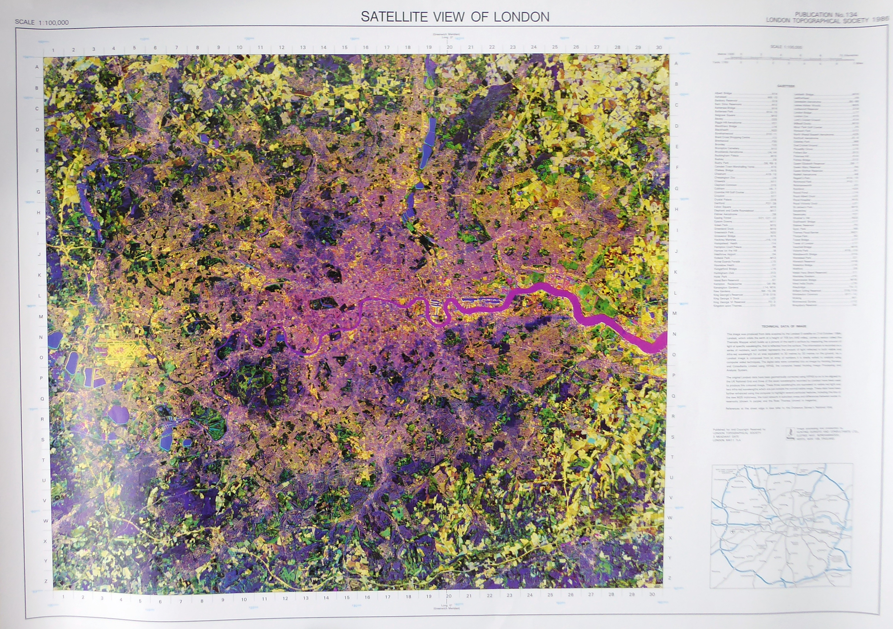
Satellite View of London, taken by Landsat on 21 October 1984
Landsat 5 image processing and production by Hunting Surveys and Consultants Ltd.
Sorry, this publication is no longer for sale
£6.70
Before the ready availability of Google Earth, this image from the Landsat 5 satellite provided a unique and exciting view of London from space The satellite orbited the earth at a height of 440 miles and measured the amount of light, at seven specific wavelengths, reflected from the earth’s surface. Three of the seven wavelengths have been used to record this image. The data has been further enhanced to highlight particular features including the line of the new M25 motorway, the road network in suburban areas and differences between water in reservoirs (shown in purple) and the River Thames (shown in Magenta). Blue references at the sheet edge refer to the Ordnance Survey’s National Grid.